

Adventurous hiking trails at clifty falls state park
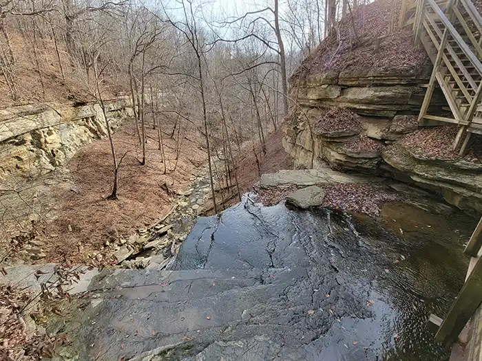
Hiking trails at Clifty Falls State Park include nearly 15 miles of moderate to very rugged trails that traverse the creek bed and canyon, taking you by four major waterfalls. An avid hiker can visit all the hiking trails at Clifty Falls State Park in one day, but it’s better to spread the hiking out over two or three days due to the steep grades and elevation changes.
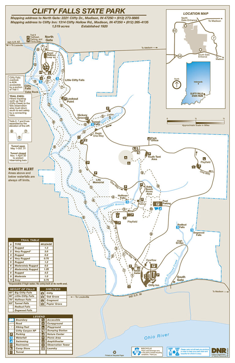
Hiking trails at clifty falls state park Info & Trails Map
Clifty Canyon Nature Preserve lies within the boundaries of the park. This 178-acre nature preserve is located in the northwest section of the park and includes most of the named waterfalls, the tunnel, and much of Clifty Creek. Be aware that this nature preserve should be left undisturbed.
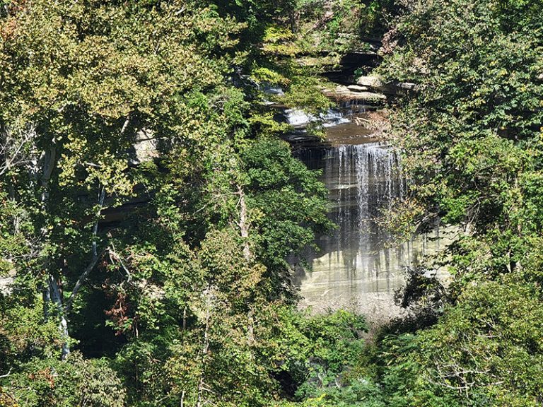
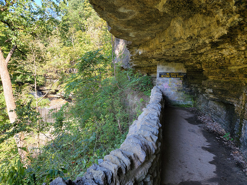
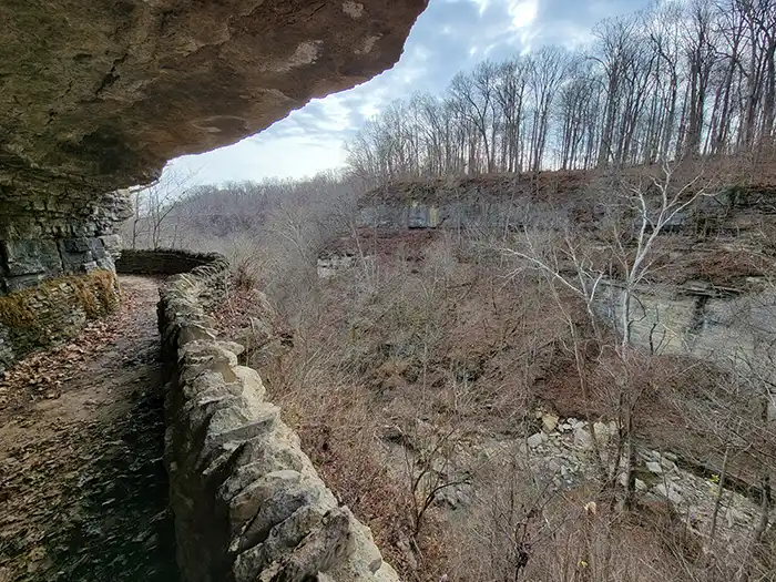
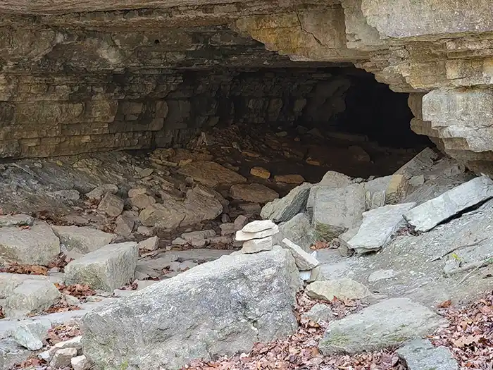
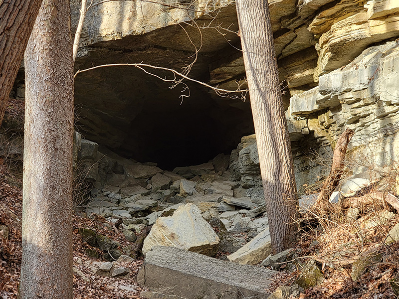
Brough’s Tunnel: The tunnel is the most notable remnant from the failed venture to build a railroad track through what is now Clifty Falls State Park. Ordinarily, you can hike through this 600-foot tunnel by flashlight, but you must follow National Decontamination Protocol to reduce the risk of transporting the fungus that causes white-nose syndrome to other locations. NOTE: the tunnel is closed from November 1st to April 30th to protect the hibernating bats from the fungus that causes white-nose syndrome. (Click here for tunnel history.) Unfortunately, due to an early spring rockslide and the possibility of additional large rocks falling near the entrance, the tunnel is closed for an indefinite period of time. The park is evaluating how to mitigate any future rockslides, with the intention of opening the tunnel in the future. Trail 5 remains open, but please avoid both tunnel entrances.
Warning: Stay on marked trails. Shortcuts cause erosion and can lead to dangerous areas. Off-trail hiking in Indiana state parks is ecologically damaging, frequently unsafe, and illegal. Violators will be prosecuted.
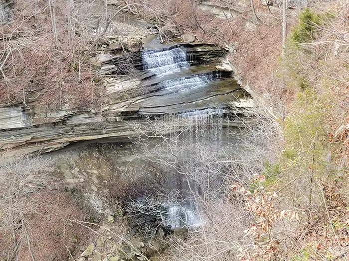
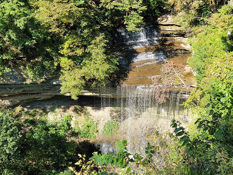
Safety Alert: The areas above and below the waterfalls are always off limits.
Closing Time: Trails close at dusk, and hikers must be off the trails by then. Walking on park roads after dark is also prohibited.
Hiking Tips:
- Carry and use the park & trails map.
- Young children should never be allowed to hike unsupervised. They must be attended by responsible individuals.
- Wear appropriate foot gear, such as hiking boots or athletic shoes.
- Know your limits. Take your time. Hills on trails are often long and steep.
- Bring plenty of drinking water to avoid dehydration.
Hiking Trails at Clifty Falls State Park
Hiking Trails at Clifty Falls State Park are very challenging. The park boasts some of the very most challenging hiking trails in Indiana. Hiking Trails are labeled 1 through 10 and correspond to the route numbers on the park & trails map.
Trail 1
0.75 miles – Rugged
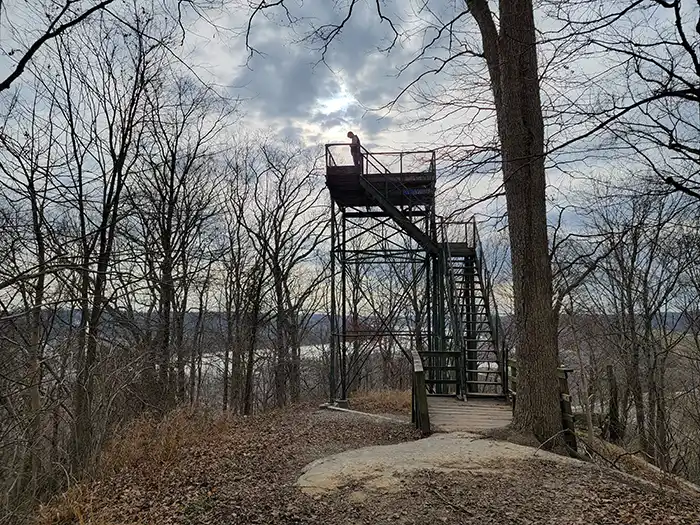
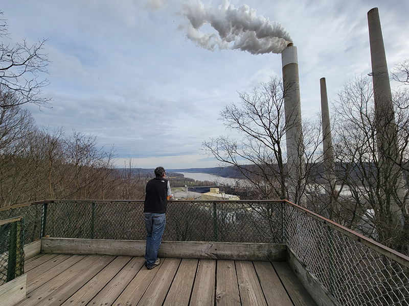
Starting at the Nature Center parking lot, this hiking trail at clifty falls state park proceeds along the ridge top to the Observation Tower overlooking the Ohio River and downtown Madison. The trail then descends some and turns back along the canyon wall, connecting with Trails 2 and 3, and continuing to the park road. Expect long, steep grades in and out of the canyon.
Trail 2
3 miles – Very Rugged
Trail 2 is primarily the stone bed of Clifty Creek and may be impassable during times of high water – the easiest hiking here is from July through November. Access in and out of the canyon (to Trail 2) is available only via connecting trails 1, 4, 5 and 8. Trail 2 ends at the north near the Big Clifty Falls observation area, but there is no connection to any trails here because of the cliff elevation. Hikers must return south on Trail 2 to a connecting trail to exit the canyon. Areas above and below all waterfalls are always off limits.
Trail 3
1 mile – Rugged
This trail starts at the park road just south of the Poplar Grove shelter house. A long grade descends to mid-canyon, then follows along the canyon. Steep grades rise up the canyon and back to Poplar Grove shelter house. An easy walk to the near side of Beech Grove (Trail 3 parking on the map) the trail then connects with Trail 4.
Trail 4
0.75 miles – Very Rugged
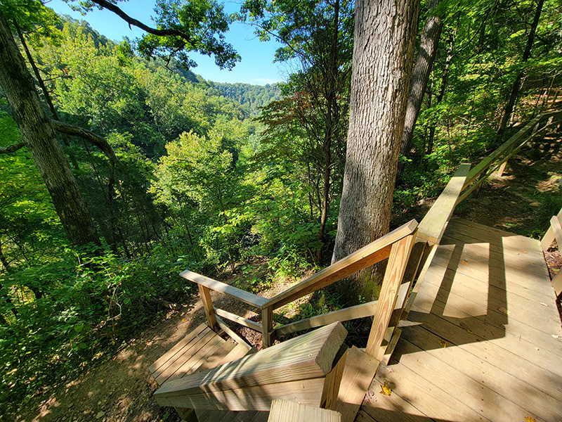
Starting at the Hoffman Falls parking lot, it is a short distance to a spectacular falls overlook. The trail then follows the canyon. At one point a spur trail takes you to Clifty Creek and connects with Trail 2. The main trail, however, continues along the canyon then has a long, steep staircase up to Lilly Memorial.
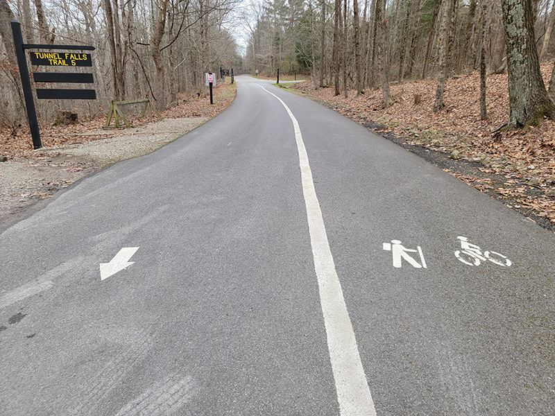
Trail 5
0.875 miles – Rugged
This trail starts at the Lilly Memorial Overlook, with a long, steep staircase to mid-canyon. The trail then follows along the canyon past both tunnel entrances, with a spur trail connecting to Clifty Creek (and Trail 2) between the entrances. The trail continues along the canyon, past Oak Grove (though a spur trail goes up to this shelter house), to Tunnel Falls. There is a steep staircase from the falls overlook up to the road and parking area. The tunnel is open May 1 – October 31. It is closed November 1 – April 30 to protect hibernating bats.
Unfortunately, due to an early spring rockslide and the possibility of additional large rocks falling near the entrance, the tunnel is closed for an indefinite period of time. The park is evaluating how to mitigate any future rockslides, with the intention of opening the tunnel in the future. Trail 5 remains open, but please avoid both tunnel entrances.
Trail 6
0.5 miles – Moderately Rugged
Trail 6 starts at the Hickory Grove parking lot and follows the canyon, just below the rim, to Lookout Point. The trail includes some very rocky footing.
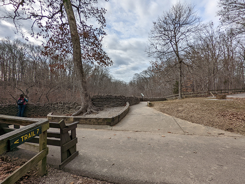
Trail 7
1.25 miles – Moderately Rugged
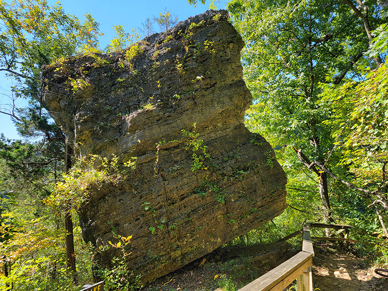
Starting at Clifty Shelter, this hiking trail at Clifty Falls State Park offers nice views of Clifty Falls (upper and lower viewpoints), then proceeds past Cake Rock and over Little Clifty Falls, along rocky footing, almost to Lookout Point. The trail returns to the picnic area east of Clifty Shelter via upper Little Clifty Creek gorge. A short section from the start of Trail 7 to a Big Clifty Falls overlook is ADA accessible.
Trail 8
4.5 miles – Rugged
This trail starts just west of the North Gate entrance to the park and proceeds south along the west rim of Clifty Canyon. A steep switchback connects to Clifty Creek (and Trail 2) across from Oak Grove shelter. A steep grade at the south end of the trail takes you down to Clifty Creek (and Trail 2), then exits the canyon to the park road or via Trail 1 to the Nature Center.
Trail 9
1 mile – Moderate
Trail 9 connects the campground to the Nature Center and Clifty Inn, via the swimming pool.
Trail 10
0.75 miles – Easy
Featuring old field ecology, this loop trail starts and ends at the back of the swimming pool parking lot. A spur connects this trail with Trail 9.
Paved Paths
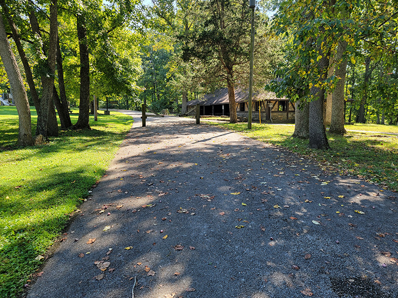
Just south of the North Gate entrance to the park is a paved walking loop that goes around the playfield and parking lots for Clifty Shelter. In addition, there is a wide walking/biking path all along the one-way road from the Tunnel Falls parking lot to the Nature Center. It’s a convenient connector of the various hiking trails at Clifty Falls State Park.
Four Falls Challenge on the Hiking Trails at Clifty Falls State Park
Traverse the rugged cliffs and canyons of Clifty Falls State Park to see the four major waterfalls on this 4-mile hiking challenge. The route includes part of the abandoned path that was once planned for the old railroad, and it takes you by the 600-foot-long tunnel that was also cut through shale and limestone for the railroad. You will also see stonework completed by the Civilian Conservation Corps on this 2- to 3-hour trek on the hiking trails at Clifty Falls State Park.
Download the map or stop by the Nature Center or Clifty Inn front desk to pick up your map, then photograph seven specific waypoints along your hike. Show these photos to the Nature Center staff after completing the hike to receive your Four Falls Challenge sticker.
Book Your Lodging Now To Enjoy The Hiking Trails At Clifty Falls State Park
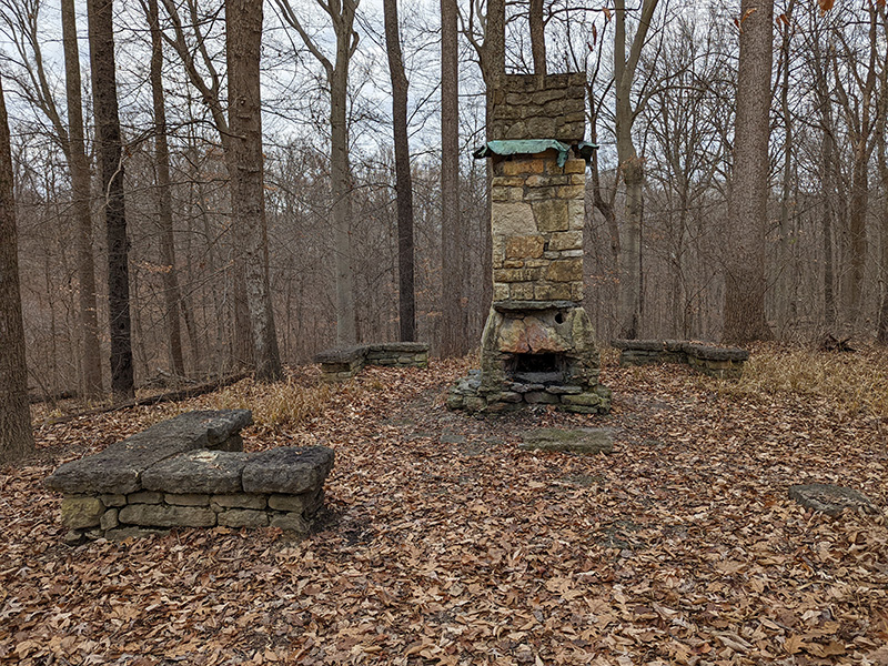
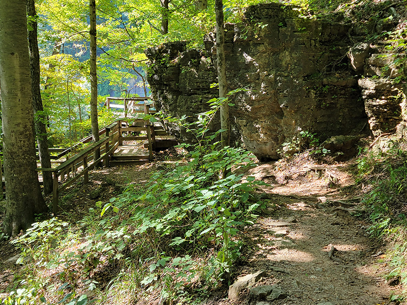
Pictures From Hiking Trails at Clifty Falls State Park
The hiking trails at Clifty Falls State Park can be very challenging, but very rewarding. If you are looking for an awesome hiking adventure then look further – it’s time you visit Clifty Falls State Park, Indiana.